For navigation applications (e.g. Alignment Tracking), I have prepared routes along some of the largest highways in densely populated countries. highway routing is based on open OSM data.
When the route is more detailed than necessary. Use Simplify Objects to reduce unnecessary complexity in contour lines, rivers, and coastlines. Simplifying objects, also known as generalizing or weeding, reduces the number of points on a complex line.
When you use Simplify Objects, you simplify complex routes by removing all interior nodes that fall within the specified tolerance width (~ 0.005km/15ft) . Line segments falling within the same corridor are generalized into a single route.

This optimization has reduced the number of vertices on the lines by almost three times, which is a significant improvement. This will help to avoid application suspension when working with long roads and other linear objects.
This simplification can be applied not only to motorways, but also to railways, rivers, coastlines, borders and contour lines
North America:
Trans-Canada Highway, Yellowhead Route, Crowsnest Highway, Shabaqua Highway, Highway 11, Highway 17, Highway 417, Autoroute Félix-Leclerc, Autoroute Jean-Lesage
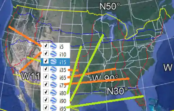
i4, i5, i8, i10, i12, i15, i16, i17, i19, i20, i22, i24, i25, i26, i27, i29, i30, i35, i37, i39, i40, i41, i44, i45, i49, i49s, i55, i57, i64, i65, i66, i68, i69, i70, i71, i72, i73, i74, i75, i76, i77, i78, i79, i80, i81, i82, i83, i84, i85, i86e, i86w, i87, i88, i89, i90, i91, i93, i94, i95, i96, i97, i99 , i110
Carretera Magdalena de Kino-Ímuris, Carretera Navojoa - Ciudad Obregón,Carretera Tepic - Puerto Vallarta, Carretera a Barra de Navidad, Autopista Acapulco - Zihuatanejo, Carretera Federal Acapulco-Pinotepa, Tapachula Arriaga; Carretera Ciudad Juárez-Miguel Ahumada, Carretera Cuencamé-Rio Grande; Carretera Piedras Negras-Nuevo Laredo, Carretera San Luis Potosi-Matehuala. Autopista de Peaje México-Querétaro
South America:

Europe:

Australia:

Africa:
Asia:
In addition, any drawing with a route in DWG/DXF format can be converted to GPX in the application.